Colorado River Board of California

Deputy Secretary of the Interior Tommy Beaudreau Assistant Secretary for Water and Science Tanya Trujillo U.S. Bureau of Reclamation Commissioner Camille Calimlim Touton

Dear Deputy Secretary Beaudreau, Assistant Secretary Trujillo, and Commissioner Touton: Thank you for your leadership and collaboration as we work together to stabilize the Colorado River Basin amidst an unprecedented, climate change-driven drought stretching over two decades.

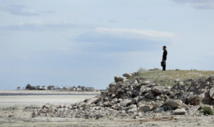
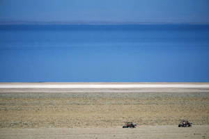
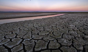
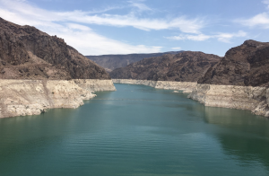
Given dire drought conditions across the region and dangerously low reservoir levels, we firmly believe that all water users within the Basin must take immediate voluntary actions to stabilize water supplies in the Basin’s major reservoirs.

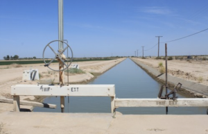
California water agencies that utilize Colorado River water supplies propose to conserve up to an additional 400,000 acre-feet of water in Lake Mead each year, beginning in 2023 and running through 2026. This water, which would otherwise be used by California’s communities and farms, will meaningfully contribute to stabilizing the Colorado River reservoir system.

We have identified a collection of proposed water conservation and water use reduction opportunities that would yield approximately 400,000 acre-feet of System Conservation water supplies that could be retained in Lake Mead each year through 2026.

California’s Colorado River water agencies are also prepared to create and store additional quantities of Intentionally Created Surplus water supplies in Lake Mead pursuant to the 2007 Interim Shortage Guidelines, under future favorable hydrologic and water supply conditions. In order to enable this water conservation, our agencies will need to utilize funding opportunities provided by the Inflation Reduction Act and other federal programs.

Each of the California agencies involved in developing this package of proposed conserved water supplies will also require your support in developing agreements for funding, potential intra- and inter- state coordination, water use accounting, and in obtaining necessary board and agency approvals over the coming weeks and months.

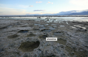
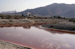
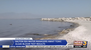
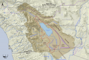
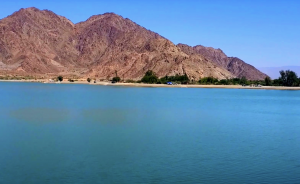
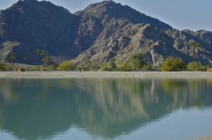
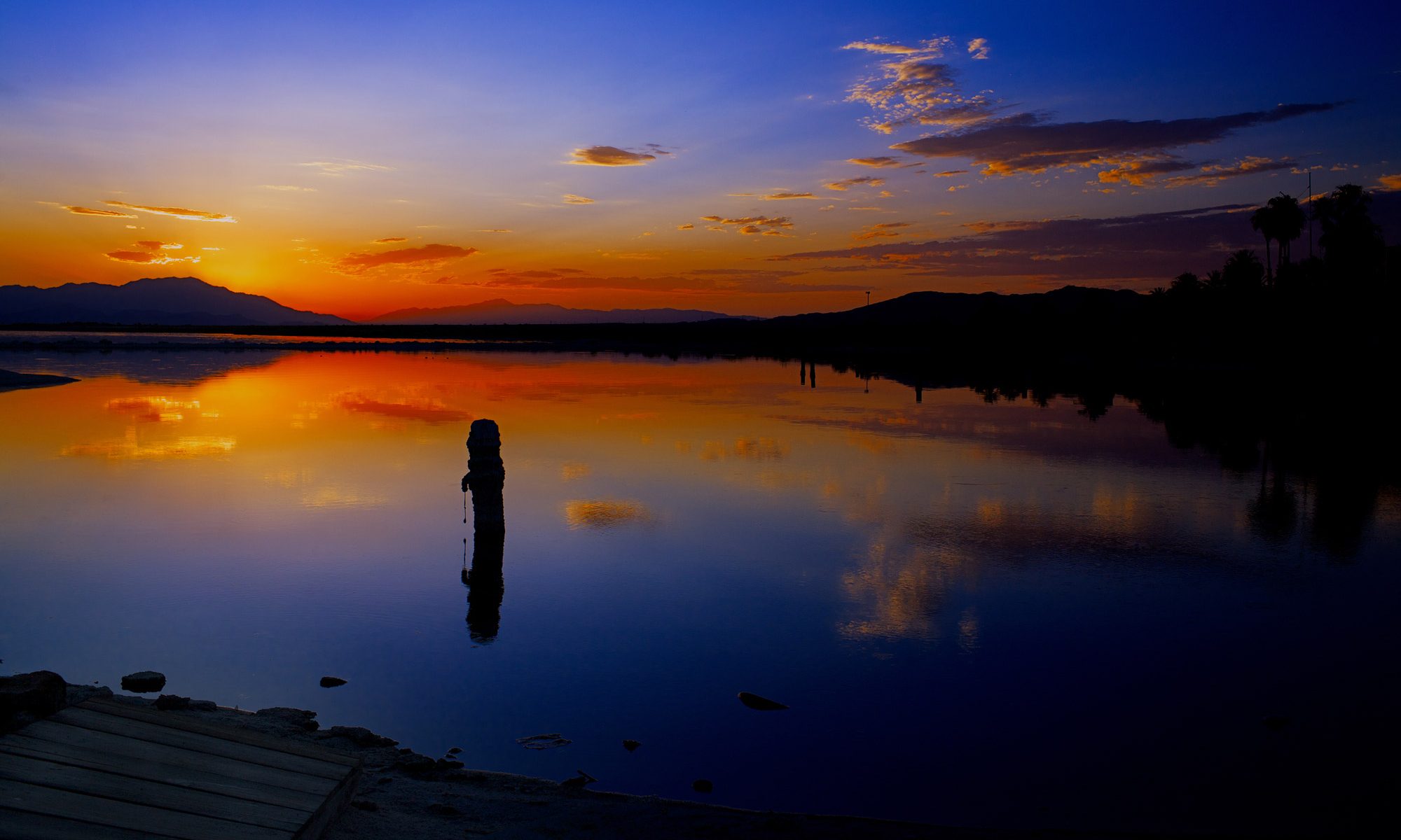
The State of California and its Colorado River agencies appreciate the collaboration of the Department of the Interior and Reclamation to stabilize the Salton Sea, which has been shrinking due to California’s existing water conservation actions and will further shrink when additional conservation actions are taken.

Voluntary water conservation actions outlined in this letter depends on a clear federal commitment to contribute meaningfully to stabilization efforts at the Salton Sea. California has long been a leader in water conservation within the Colorado River Basin, including through the nation’s largest agricultural to urban water conservation and transfer program, the Quantification Settlement Agreement, and through billions of dollars in investments in agricultural and urban water conservation.

In fact, through a variety of activities, California’s water agencies have voluntarily conserved nearly 2.0 million acre-feet of water supplies in Lake Mead since 2007 that has added more than twenty feet to Lake Mead elevations and aided other Lower Basin water users from experiencing previously agreed upon shortage reductions that would have otherwise occurred as early as 2015. Most recently, our water agencies have been committed to constructive participation in discussions among the basin states that began even before to the Commissioner’s call in June for urgent voluntary water conservation. While a broad multi-state agreement to conserve water across the Basin has not been reached, the California agencies propose to take voluntary action now to conserve water in coming months.

It is California’s intention that this proactive voluntary action builds on existing agreements, contracts, compacts, and water rights to catalyze broader basin-wide conservation and helps to avoid protracted litigation that might otherwise result from regulatory or mandated actions. California and its Colorado River agencies believe that it is imperative for the Department of the Interior and Reclamation to immediately reengage the seven Basin States, Tribes, and Mexico in efforts to identify additional water conservation and water use reduction activities to stabilize the Colorado River reservoir system. Additionally, California and the agencies look forward to working with you and others across the Basin with respect to the administrative actions identified in Reclamation’s August 16, 2022, News Release.

Sincerely,

CC: California Secretary for Natural Resources Wade Crowfoot California Department of Water Resources Director Karla Nemeth Colorado River Basin States Principals


ORIGINAL DOCUMENT


Why the Salton Sea is turning into toxic dust

The Salton Sea, California’s most polluted inland lake, has lost a third of its water in the last 25 years. New research has determined a decline in Colorado River flow is the reason for that shrinking.

As the lake dries up, the concentration of salt and chemicals in the remaining water has increased dramatically, causing a mass die-off of fish and birds, including endangered species. The dry lakebed, coated in the salty, toxic water, becomes dust that causes respiratory problems for nearby residents.

“It is an environmental catastrophe,” said Juan S. Acero Triana, UCR hydrologist and lead author of a new study focused on understanding water movement on and below Earth’s surface near the Salton Sea, a research field called hydrology. The study was funded by the National Science Foundation’s Innovation at the Nexus of Food, Energy and Water Systems, or INFEWS, program.

A view of the drying, shrinking Salton Sea and the playa left behind. (Stan Lim/UCR)

There have been a variety of hypotheses about why the water levels are steadily declining. Some blame climate change and heat for drying up the lake. Others suspect that agriculture could be to blame. As irrigation systems get more efficient and crops are modified to use less water, it means less water getting into the Salton Sea. However, the researchers say these are not the biggest causes of the sea’s decline.

“There is less water coming from the Colorado River into the Sea, and that is driving the problem,” said Hoori Ajami, UCR hydrologist, study co-author and principal investigator. This finding, and the methods used to obtain it, are now published in the journal Water Resources Research.

The researchers considered all major processes impacting the water balance of an endorheic lake like the Salton Sea, where water flows in but not out to any tributaries. Endorheic lakes worldwide have been shrinking in recent decades at what the researchers call an “alarming” rate due to the combined effects of global warming and diversion of water for agricultural and industrial purposes.

A view of the drying, shrinking Salton Sea and the playa left behind. (Stan Lim/UCR)

To understand the reasons for the Salton Sea’s decline, the researchers used a hydrologic model that accounted for all processes in the surrounding areas that impact the lake’s water balance, including climate, soil types, land slope, and plant growth.


Geographically the model included data not only about the Sea itself, but also from the surrounding watershed, streams entering the lake, and the land area that drains into those streams.

Data for the model was hard to come by as this is a transboundary basin on the US-Mexico border between California and Baja California Norte, and stakeholders may have been reluctant to share data that could alter previously earned water rights. However, using publicly available data and data mining techniques, UCR researchers were able to simulate long-term water balance dynamics and identify reduced Colorado River flows as the main cause of the Salton Sea shrinking.

“It’s not entirely clear, however, whether the decline in Colorado River water is more due to global warming drying out the river, or reductions in allocation levels to California, or both,” Acero Triana said.

Despite that lingering ambiguity, the researchers say the study should send a message to water management agencies and lawmakers that the Salton Sea watershed should be considered part of the Colorado River basin.

“Usually, the Sea is considered an independent system, and a watershed-centric approach considering surface and groundwater resources is needed to find a solution,” Ajami said. “As the environmental risks of a shrinking Sea mount, all parties must work together to mitigate the danger.”

SOURCE


Colossus

The Turbulent, Thrilling Saga of the Building of Hoover Dam

COLOSSUS

As breathtaking today as when it was completed, Hoover Dam ranks among America’s most awe-inspiring, if dubious, achievements.

This epic story of the dam—from conception to design to construction—by Pulitzer Prize-winning journalist and Los Angeles Times columnist Michael Hiltzik exposes the tremendous hardships and accomplishments of the men on the ground—and in the air—who built the dam and the demonic drive of Frank Crowe, the boss who pushed them beyond endurance.

It is a tale of the tremendous will exerted from start to finish, detailing the canny backroom dealings by Herbert Hoover and Franklin D. Roosevelt, the herculean engineering challenges Crowe faced, and the terrific union strikes by the men who daily fought to beat back the Colorado River.

Colossus tells an important part of the story of America’s struggle to pull itself out of the Great Depression by harnessing the power of its population and its natural resources.

Lithium Valley? With push to EVs, all eyes are on the Salton Sea

Southern California could be the Middle East of this century. Companies are scrambling to get at the mineral stew bubbling beneath the Sonoran Desert.

By  | bstaggs@scng.com | Orange County Register – dailybulletin.com


Salton Sea Lithium Valley

Those drawn to the other-wordly landscape surrounding the Salton Sea, some 45 minutes southeast of Palm Springs, have long been lured by potential.

Potential to plant crops that help feed the country or solar panels to help power it in the wide open, affordable land in Imperial County. Potential to pursue bohemian, artistic lives in Bombay Beach or nearby Slab City. Potential to spot migratory birds who make their temporary home at this largest lake in California.

That potential hasn’t always panned out. With both local and imported water scarce, farmers sometimes are paid to keep their fields fallow. The solar industry hasn’t delivered the once-promised jobs or a huge spike in land values. And there are regular reports of massive bird and fish die-offs, with the sand of some lakeside beaches made from the bones of fish that couldn’t survive the shallow, salty lake’s oxygen-deprived waters.

But now, everyone from General Motors to the U.S. Department of Energy to Warren Buffet seems to believe the Salton Sea’s greatest potential so far remains untapped: its potential to become known the world over as Lithium Valley.

Demand for lithium has skyrocketed over the past 30 years, since the world’s lightest metal also happens to be fantastic at storing energy. Lithium’s ability to quickly charge, recharge and transfer lots of energy has made it the primary component in batteries for everything from laptops to pacemakers to cell phones. Now, lithium is the material of choice for batteries to store solar and wind energy — and to power electric vehicles.

Tens of millions of EV batteries soon will be needed each year. In August, California announced a plan to ban the sale of new gas-powered vehicles starting in 2035, and more than a dozen states are expected to follow suit. And federal lawmakers have passed several funding packages that also push consumers and car manufacturers toward EVs, with countries around the world pursuing similar goals.

Unfortunately, lithium isn’t particularly abundant or easy to get at. So the growing demand has triggered a geopolitical scramble — sometimes called a “white gold rush,” in reference to lithium’s silvery-white color — to find new, cost effective ways to source the material.

Lithium Valley.

That’s where the Salton Sea Geothermal Field comes in.

Researchers believe there may be enough lithium bubbling a mile or more beneath the desert adjacent to the sea to meet domestic needs for the foreseeable future. They believe there might even be enough lithium left over that the U.S. could export the prized material to other countries.

Some locals remain understandably skeptical. But experts working on these plans insist the type of lithium extraction operations they’re eyeing, which aren’t yet happening anywhere in the world, present few environmental problems while offering significant economic potential for the region.

Salton Sea water managers await toxic algae bloom test results as drought intensifies problem

SOURCE: News Channel 3 – kesq

As of today, it’s not clear if there’s a cause for concern over any toxic algae blooms at the Salton Sea.

The California State Water Resources Control Board has yet to release test results from samples submitted by Imperial County Environmental Health officials this week.

The state works with Riverside and Imperial counties to manage the Salton Sea, as the waterway spans across both counties.

Toxic Water

As of June 30 2022, there were “no new observations made of the bloom for 30 days”, according to the State Water Resources Control Board.

The alert noted “observations of scum and surface accumulation of algal material present at this site indicating elevated health risk to humans and animals. Surface accumulations may become stranded along shoreline, children and dogs should avoid contact.”

It also noted “the exact location, extent and toxicity of the reported bloom may not be accurate and may not be affecting the entire waterbody,” therefore its recommended the waterbody manager be contacted for current conditions since “the bloom may still be present or may have subsided.”

County environmental officials partner with the state to help advise the public in the surrounding community if a toxic algae bloom is detected.

Salton Sea

“The last time we posted signage was in mid-July, so the detection would’ve been the week prior,” said Vanessa Ramirez, Environmental Health Compliance Specialist for Imperial County.

However, unless testing is conducted, county officials don’t always know whether or not toxic algae is present at the Salton Sea. If a potential harmful algal bloom is observed and reported, then county officials will visit the site and conduct an investigation to make a determination.

Currently, the state water managers conduct what’s called holiday testing. “The state water board has a program for Memorial Day, July 4, and for Labor Day. Since we’re local, we’ll go out there on their behalf, do the sampling, and send the sample to the state” for testing, said Vanessa Ramirez, Environmental Health Compliance Specialist for Imperial County.

Depending on the level of danger determined, action is then taken to address the bloom. Those steps can range from putting up signs warning the public to closing waterways for recreational use.

Toxic algae blooms used to be more seasonal, but that’s no longer the case due to a variety of reasons, including warmer temperatures and California’s ongoing drought.

When water recedes, its allows for “an increase in nutrient activity in a particular area,” according to Jeff Lamoure, Deputy Director of Environmental Health for Imperial County.

“You see maybe a concentration of the Cyanotoxins in the water that causes them to bloom more frequently. You’re not having as much water movement because of the receding shorelines, so they’re kind of working together to causes these activities to increase,” added Lamoure.

Existing warnings for people to stay out of the water due to dangerous algae blooms in Lake Elsinore, in western Riverside County, and Big Bear Lake, in San Bernardino County, are prompting growing interest on the current status of algae blooms at the Salton Sea.

The lake, located in southern Riverside and northern Imperial counties, has had a history of toxic algae blooms in previous years.

Exposure to toxic algae blooms can cause severe illness among people and animals, and death among wildlife in some instances.

VIDEO

A Dead Sea. The history of one of North America’s most polluted bodies of water.

By Kyle Paoletta

thenation.com

The United States’ century-old ambition to impound and divvy up every drop of water that could be wrung from its most arid stretches began with a flood. A private firm called the California Development Company (CDC) completed a canal in 1901 that zigzagged across the state’s border with Mexico in order to connect the Colorado River to a dry riverbed that aspiring farmers had already begun to section off for themselves, heeding the proclamation by the newly founded Imperial Valley Press that the region constituted “the most fertile body of arid land on the continent.”

The former bed of the Salton Sea, 2019. (David McNew / Getty Images for Lumix)

Only two years later, the CDC’s canal was filled with silt, and the customers who had paid up-front for rights to water that could no longer be delivered started filing lawsuits. The CDC dug a new ditch next to the original canal, but in its desperation to act quickly, the company neglected to build any means of controlling how much of the river was diverted into this new channel: If the Colorado flooded, the excess water had nowhere to go but toward the Imperial Valley. To make matters worse, 1905 was an unusually wet year, and by autumn the Colorado was flowing with the same force as Niagara Falls. The CDC’s diversion held, but that only served to funnel the entire river downhill into the valley’s center, a vast salt plain then known as the Salton Sink. It would take two years before the river was contained. Once it was, California had a new body of water, the Salton Sea, almost twice the size of Lake Tahoe.

The Salton Sea was formed before the Hoover Dam, before Lake Powell, before the aqueducts that stretch for hundreds of miles across the West. But there were many more new water features on the horizon: The Bureau of Reclamation, created to develop a “system of nationally-aided irrigation for the arid reaches of the far West,” began building dams across the region in the first decade of the 1900s. It also acquired control of many private water schemes in order to subsidize the price of the water delivered to farmers and residents of the future communities that were being built by urban developers.

The West became dependent on these waterworks as soon as they were constructed, even as their forerunner, the Salton Sea, was slowly transforming into a surreal and toxic landmark. The so-called sea’s salinity began to rise as soon as it was formed, because its water evaporated steadily in the unrelenting sunshine. Over the following decades, the lost water began to be replenished by the runoff from the acres of farms and feedlots spreading across its southern edge. But as the basin was refilling, the runoff was turning the Salton Sea into one of the most polluted bodies of water in the West—a lake that gives off a sulfuric stench of eggs and kills migrating birds by the thousands. The western shore, meanwhile, was littered with detritus from weapons testing by the United States military, and along the eastern shore you could find a tourist town called Bombay Beach that would be all but abandoned in the 1970s after being flooded with runoff. Bombay Beach has since found a second life as an artists’ colony that, starting in 2015, has staged a yearly “biennale” that bills itself as a “renegade celebration of art, music, and philosophy that takes place on the literal edge of western civilization.” But everywhere around the Salton Sea, the shoreline is receding, leaving thousands of acres of polluted playa—the earth that remains after the water has evaporated—which, once it becomes airborne on the wind, produces some of the worst asthma rates in California.

See full article

Lake that predated Salton Sea came and went as the Colorado River changed course

By Thomas Fudge / Science and Technology Reporter -kpbs

U.S. Bureau of Reclamation – This undated map of the Salton Sea basin shows the shape and size of a full Lake Cahuilla as indicated by the dotted red line.

Before the Colorado River was tamed by dams and dikes it was a free flowing, flooding river that often changed course, sometimes dramatically. Though it typically flowed south to the Gulf of California, in years of powerful floods it would flow into the Salton Sea Basin, and fill it up to form what we call Lake Cahuilla.

Since about 612 B.C. Lake Cahuilla has filled up seven times, the last time in 1733. The flooding Colorado would create a huge lake that stretched from what’s now Palm Springs, California in the north to well beyond Mexicali, Mexico in the south.

Thomas Rockwell is a geology professor at San Diego State who examined charcoal and other organic matter to determine when the lake filled and receded.

“Before we dammed up the Colorado River, the Colorado River would flood, seasonally. And during six of these periods in the last 1,100 years, the Colorado flowed, unabated, into the Salton trough, and filled Lake Cahuilla to an elevation of about 40 feet,” said Rockwell.

Rockwell adds that when it filled with Colorado River water the lake would be 100 meters deep at its deepest part and, as Rockwell says, it would have an elevation of 13 meters (40 feet) above sea level. It would dry up when the Colorado reset its course toward the gulf of California.

The study sheds light on the human relationship with the land. Rockwell says archeological evidence shows how American Indian populations adapted to the changing lake.

“You had various Native American communities, the Cocopah, the Cahuilla, that would live along the shoreline and fish when the water was high. The Cahuilla are known historically to farm the bottomlands when the lake wasn’t there,” he said.

The Salton Sea Basin is at the southern end of the San Andreas Fault. Rockwell said his ulterior motive, as a geologist, was to study the history of earthquakes in the region.

“Now that we have this high resolution study of lakes, we’re putting together a high resolution study of earthquakes for the last 1,100 years,” Rockwell said. “Most of the earthquakes on the southern San Andreas fault occurred while the lake was full.”

He said the weight and the pressure of a full Lake Cahuilla would weaken the strength of an earthquake fault, making it more likely to fail.

The Salton Sea was created in 1905 when the Colorado River breached a dike and flooded part of the basin. What some view as a technical failure of flood control, Rockwell sees as a natural occurrence, given the history of Lake Cahuilla.

When asked what he thought of efforts to maintain the Salton Sea, which has been sustained through farm runoff, Rockwell said he understands the importance of the Salton Sea to migratory birds. But in its natural state, he said the Salton Sea would be entirely dry today.


WATER 101: A Recap of Where We Are Amidst a Historic Drought

I Imperial Valley— Local farmers may soon be forced to bite the bullet and find ways to use significantly less water in 2023 — potentially for a lot longer.

This drastic measure may come as a result of an emergency water conservation effort to prevent further depletion of the Valley’s main source of water, the Colorado River. If less water flows down the Colorado River, the consequences could be catastrophic for the two reservoirs — lakes Mead and Powell — that feed into the so-called basin states.

For example, if water levels in Lake Mead continue dropping, it could bring water and hydropower to a grinding halt, all due to a relentless drought over two decades.

Measuring Water

The Imperial Irrigation District, the largest water agency in California, is nearing final negotiations with Arizona — one of the lower basin states — to see how much water each state will be able to conserve. And the bar is high.

In June, the federal Bureau of Reclamation requested the states, water agencies and Native tribes along the Colorado River basin to propose ways to collectively conserve up to 4 million acre-feet of water in 2023. They must all reach a deal by mid-August.

How this will impact the farmers who rely on the Colorado River to grow their crops and sustain the principal economic engine of the Imperial Valley can perhaps be better understood through the various ways the Imperial Irrigation District distributes water throughout the region, and how farmers make do with a persistent drought that seems to have no end.

Measuring Water

How much is an acre foot of water?

Water, in general, is measured by the acre-foot, meaning that one acre-foot covers an acre of land one foot deep. One acre-foot of water equals about 326,000 gallons, enough to supply a family of four or five for one year.

How much does the Imperial Valley get?

The IID is allocated 3.1 million acre-feet of water, of which some 500,000 acre-feet of water are transferred to other agencies including the Metropolitan Water District, San Diego County Water Authority, and the Coachella Valley Water District.

The remaining 2.5 million acre-feet of water are then distributed to farmers, residents and businesses throughout the Imperial Valley each year.

How much of it goes to farmers and how much to residents?

Of the 2.5 million acre-feet of water that does get distributed within the Imperial Valley, some 21,631 acre-feet of water is distributed to industrial and commercial users while some 32,580 acre-feet of water is distributed to residents.

In short, 97.8 percent of water goes to agriculture while just over 2 percent goes to residential, industrial and commercial users.

COMPLETE ARTICLE

History of Lake Cahuilla before Salton Sea

Cahuilla Lake – Miragenews
San Diego State University

Today, the Salton Sea is an eerie place. Its mirror-like surface belies the toxic stew within. Fish skeletons line its shores and the ruins of a once thriving vacation playground is a reminder of better days. But long before agricultural runoff bespoiled the Salton Sea, the lakebed it now occupies was home to a much larger body of water known as Lake Cahuilla. The lake was six times the area of the Salton Sea and once covered much of Mexicali, Imperial and Coachella valleys.

“It was a freshwater lake that was about 100 meters deep in its deepest part,” said San Diego State University emeritus professor of geology Tom Rockwell. “It extended from up near Palm Springs southward into Mexico, so it was a very extensive lake.”

Lake Cahuilla has gone through many cycles of filling and drying out over thousands of years. A new study by Rockwell and his colleagues used radiocarbon dating to determine the timing of the last seven periods of filling. The research sheds light on both the history of human occupation in the area and its seismic past.

Wet and dry periods

Lake Cahuilla got its water from the Colorado River. Once a mighty waterway before it was siphoned off for agriculture and urbanization, the Colorado normally flowed south into the Gulf of California. But periodically, it switched course and began to drain northwest into the Salton Trough, refilling Lake Cahuilla. When full, the water level in the lake could rise to 13 meters above sea level.

“It has this tendency to flip-flop back and forth,” said Rockwell. “But when the Colorado drains to the Gulf of California, Lake Cahuilla would just dry up over a period of 50, 60, or 70 years.”

Sediments from these repeated filling events resulted in fertile soils in the Imperial Valley. An irrigation canal was created around 1900 to bring water from the Colorado River to the Valley for farming, but in 1905, springtime flooding ruptured the canal and gushed toward the Salton Trough, partially refilling the lake to form the Salton Sea. Once the breach was repaired, the water level remained well below that of Lake Cahuilla’s previous incarnations.

To reconstruct its early hydrologic history, Rockwell’s team sampled charcoal, wood, seeds and other organic matter from nearly a dozen in the former lake’s basin. The charcoal samples likely came from cooking fires once used by Indigenous people who inhabited the region.


Lake Cahuilla
Lake Cahuilla

Historical accounts told of the Colorado River flowing toward the Gulf of California rather than the Salton Trough in 1706, indicating that the lakebed was dry at that time. Based on radiocarbon dating of drowned stumps, Rockwell’s team determined that the last lake to form before the advent of the Salton Sea reached its highest point around 1731.

“But it had to have started drying up by 1732 or 33,” Rockwell said.

Based on an approximate rate of evaporation, that would have made it possible to completely dry out by the time Juan Bautista de Anza’s expedition passed through the area in 1774 and reported that the lakebed had no water in it.

The Salton Sea could produce the world’s greenest lithium, if new extraction technologies work

Katie Brigham – Wednesday – CNBC

About 40 miles north of the California-Mexico border lies the shrinking, landlocked lake known as the Salton Sea. Though the lake was once the epicenter of a thriving resort community, water contamination and decades of drought have contributed to a collapse of its once-vibrant ecosystem and given rise to ghost towns.

The Salton Sea could produce the world’s greenest lithium, if new extraction technologies work

But amid this environmental disaster, the California Energy Commission estimates that there’s enough lithium here to meet all of the United States’ projected future demand and 40% of the world’s demand. That’s big news for the booming electric-vehicle industry, as lithium is the common denominator across all types of EV batteries.

Traditionally, lithium extraction involves either open-pit mining or evaporation ponds, which work by pumping lithium-containing brine to the surface and waiting for the water to dry up. Both of these methods have huge land footprints, are often very water intensive and can create a lot of contamination and waste.

But at the Salton Sea, three companies are developing chemical processes to extract lithium in a much cleaner way, taking advantage of the Salton Sea’s rich geothermal resources. Near the lake, there are already 11 operating geothermal power plants, 10 of which are owned by Berkshire Hathaway’s renewable energy division, BHE Renewables.

“We are already pumping 50,000 gallons of brine per minute across all of our 10 geothermal facilities to the surface,” said Alicia Knapp, president and CEO of BHE Renewables, “and we’re using the steam from that brine to generate clean energy. So we’re really halfway there in that we’ve got the lithium right here in our hands.”

Two other companies, EnergySource and Controlled Thermal Resources, or CTR, are also developing joint geothermal-lithium facilities at the Salton Sea, and General Motors has already committed to source lithium from CTR.

This new industry could be a major economic boon to the region, where the majority Mexican-American community faces high rates of unemployment and poverty and suffers health impacts from the toxic dust that blows off the Salton Sea’s drying lake bed.

“We’re cautiously excited in regards to the Lithium Valley,” said Maria Nava-Froelich, the mayor pro tem of Calipatria, California, the city of about 6,000 where the geothermal power plants are located. “We see it as a game changer here for Imperial County.”

Nava-Froelich hopes the industry will bring much-needed jobs and development to the region, helping to revitalize communities that have seen an exodus of young people seeking opportunities elsewhere. And environmentalists hope that the influx of attention and money will hasten California’s efforts to restore the environment in and around the Salton Sea.

If ever there were a time to bet on domestic mineral projects, it might be now. At the end of March, President Joe Biden invoked the Defense Production Act to boost production of EV battery minerals such as lithium, nickel, cobalt, graphite and manganese.

But extracting lithium from geothermal brines has never been done before at scale, so it remains to be seen whether the electric-vehicle industry, the local community and/or the environment will actually benefit.

Lithium Valley

This isn’t the first time there’s been interest in lithium recovery at the Salton Sea. Hyped start-up Simbol Materials developed a demonstration plant, but the company ceased operations in 2015 after a failed acquisition attempt by Tesla and never developed a commercial-scale facility.

Since then, demand for lithium has shot up and, after falling sharply in 2018, prices are surging once again, incentivizing projects that might not have been economical before. If the current trio of companies can prove their technology works, they stand to make a lot of money from the hundreds of thousands of tons of lithium in the area.

“The Salton Sea field, fully developed, could well serve over 600,000 tons a year, when the world production is less than 400 [thousand] now,” said Rod Colwell, CEO of CTR.

Unlike Berkshire Hathaway and EnergySource, CTR doesn’t have any geothermal power plants in the region, so it’s building a joint geothermal and lithium recovery facility all at once. Currently, the company is constructing a demonstration plant and plans to open its first full-scale facility by the beginning of 2024, providing 20,000 tons of lithium to GM.

Colwell estimates that CTR’s first plant will cost just shy of $1 billion, a steeper price per ton of lithium than many traditional lithium recovery projects. But all three companies expect that price to drop as the technology develops further.

CTR is using ion-exchange technology, which it developed in partnership with Bay Area-based Lilac Solutions, to recover lithium. In this method, geothermal brine flows through tanks filled with ceramic beads, which absorb lithium from the brine. When the beads are saturated, the lithium is flushed out with hydrochloric acid, and lithium chloride remains. This is an intermediary product that CTR plans to refine on-site, yielding lithium carbonate or lithium hydroxide, a powder that’s ready to be processed and transformed into precursor chemicals and then manufactured into battery cells.

Berkshire Hathaway is also using ion-exchange technology, though the company hasn’t revealed as many specifics as CTR about how it will work.

EnergySource has developed technology known as Integrated Lithium Adsorption Desorption, or ILiAD, and it’s jumping straight into building a full-scale facility, which it expects to be operational by 2024.

What we see in terms of production costs is that geothermal brine should be around the first quartile in terms of market competitiveness,” said Derek Benson, CEO of EnergySource.

Notably, all three companies plan to refine the lithium on-site, a process that normally takes place overseas. But the companies aren’t equipped to handle additional steps, such as chemical processing and battery cell manufacturing, which still primarily take place in Asia.

“The rest of the supply chain hopefully in the coming years will also be developed in the U.S.,” said Knapp, “so that we’re able to go straight from lithium and other minerals in the ground to batteries that we’re using to run our infrastructure.”

EV battery maker Italvolt recently announced plans to launch a new company, Statevolt, with the intent to build a $4 billion gigafactory in Imperial Valley that would produce enough lithium-ion batteries for 650,000 electric vehicles per year. Statevolt signed a letter of intent to source lithium and geothermal power from CTR, but did not respond to CNBC’s inquiry about whether it will do chemical processing on-site.