The multi-state talks, which have been ongoing in fits and starts for months, were focused on achieving unprecedented water cuts to save the Colorado River – a system that provides water and electricity to more than 40 million people in the West.
A showdown over Colorado River water is setting the stage for a high-stakes legal battle
As less and less water has been flowing through the river and its reservoirs, US Bureau of Reclamation Commissioner Camille Touton last year called on the basin’s seven states – California, Arizona, Nevada, New Mexico, Colorado, Utah and Wyoming – to figure out how to cut 2 to 4 million acre feet of usage, or as much as 30% of their river water allocation.
If they couldn’t agree on how to do it, Touton vowed the federal government would step in.
On Monday, six states – including lower basin states of Arizona and Nevada – released a letter and a proposed model for how much Colorado River water they could potentially cut to stave off a collapse and prevent the nation’s largest reservoirs, Lakes Mead and Powell, from hitting “dead pool,” when water levels will be too low to flow through the dams.
The maximum amount of basin-wide cuts the six states are proposing in their model is 3.1 million acre feet per year. It accounts for water conservation and evaporation and, if approved, could kick in if reservoir levels fall to catastrophically low conditions.
California – the largest user of Colorado River water – is conspicuously absent from the text and will release its own letter and model calling for more modest annual cuts of around 1 million acre feet later this week, JB Hamby, the chair of the Colorado River Board for the state and an Imperial Irrigation District board member, told CNN.
“Six western states that rely on water from the Colorado River have agreed on a model to dramatically cut water use in the basin, months after the federal government called for action and an initial deadline passed. California — with the largest allocation of water from the river — is the lone holdout. … Arizona, Nevada, New Mexico, Colorado, Utah and Wyoming sent a letter Monday to Reclamation, which operates the major dams in the river system, to outline an alternative that builds on existing guidelines, deepens water cuts and factors in water that’s lost through evaporation and transportation. Those states propose raising the levels where water reductions would be triggered at Lake Mead and Lake Powell, which are barometers of the river’s health. The model creates more of a protective buffer for both reservoirs — the largest built in the U.S. It also seeks to fix water accounting and ensure that any water the Lower Basin states intentionally stored in Lake Mead is available for future use. ... ” Read more from the Associated Press here: California holding out as Nevada, other states agree to Colorado River cuts
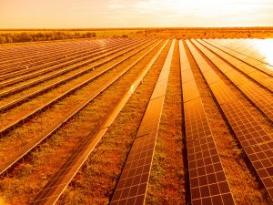
The Imperial Valley transitioning from farming to solar energy production is threatening to wipe out a way of life in the region. It’s forcing difficult choices among farming families, many of whom have been in agriculture for generations.
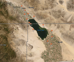
In many ways, the Salton Sea represents the current dilemma of the Imperial Valley. Originally created with water from the Colorado River, the Salton Sea has for years been contaminated with agricultural run-off, and is currently in the process of an environmental clean-up and restoration. But that farm water run-off may stop flowing, meaning the Salton Sea itself may cease to exist.
“You’ve got farmers using less water, and then less water going into the Salton Sea, [so] the sea shrinks,” says Sammy Roth, LA Times energy reporter.
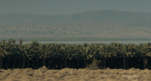
The Imperial Valley finds itself at an inflection point. Farmers there are the biggest user of water from the Colorado River. But with less water available from the increasingly dry river, and seven other states with competing water rights, some farmers are pulling out their crops, and planting something else — solar panels.
“The future is uncertain with water, [and] solar is a reliable income stream,” explains Roth, who has been chronicling California’s transition to renewable energy sources. “They’ve got 17,000 acres of solar that are built down there. … It’s not a lot compared to 450,000 acres of farms … but it’s a significant amount and it’s growing.”
Aside from possibly causing the disappearance of the Salton Sea, transitioning from farming to solar energy production is threatening to wipe out a way of life in the region. It’s forcing difficult choices among farming families, many of whom have been in agriculture for generations.
“You have these fights that are starting to play out between agricultural landowners,” says Roth. “On the one hand, it’s climate benefits, it’s saving water on the Colorado, it’s generating income for some of the landowners. On the other hand, you’ve got plenty of farmers and also farm workers who see this as a threat to their way of life, [and] a threat to the agricultural economy.”
Complicating the decision is decades of mistrust that has been built up between rural communities and urban areas over water. Imperial Valley farmers have been growing food, especially winter vegetables, that feed the nation, and are sold for export. But as they’ve grown in population, urban areas like LA have demanded more water from rural areas.
“Cities are going to continue to grow,“ explains Roth. “One way or another, we’re going to have to figure out a way to bridge some of these trust gaps or things are not going to work out well for anybody.”
There are possible benefits for farmers who have switched, says Roth. There is the potential to make more money harnessing solar power than growing crops, however it depends on the kinds of crops historically grown on a piece of land, as well as the quality of soil and availability of water. Aside from winter vegetables, the Imperial Valley also grows alfalfa and grass for livestock, which adds nuance to the argument that farmers are feeding the nation.
“Many of us eat dairy, eat beef, the stuff that comes from cattle,” says Roth, alluding to the higher environmental costs that come from choosing an animal-based diet. “[Growing alfalfa] is not quite the same as growing food directly.”
Whichever choice farmers make — continue farming or switch to solar — the contaminated Salton Sea figures into the complicated dynamics of the region in an increasingly warming climate, says the LA Times’ Sammy Roth.
“How do you address the impact of that on the Salton Sea and not … let it become worse and worse for the wildlife that depend on it? And for the people who are going to be breathing dirtier air if the sea continues to shrink?”
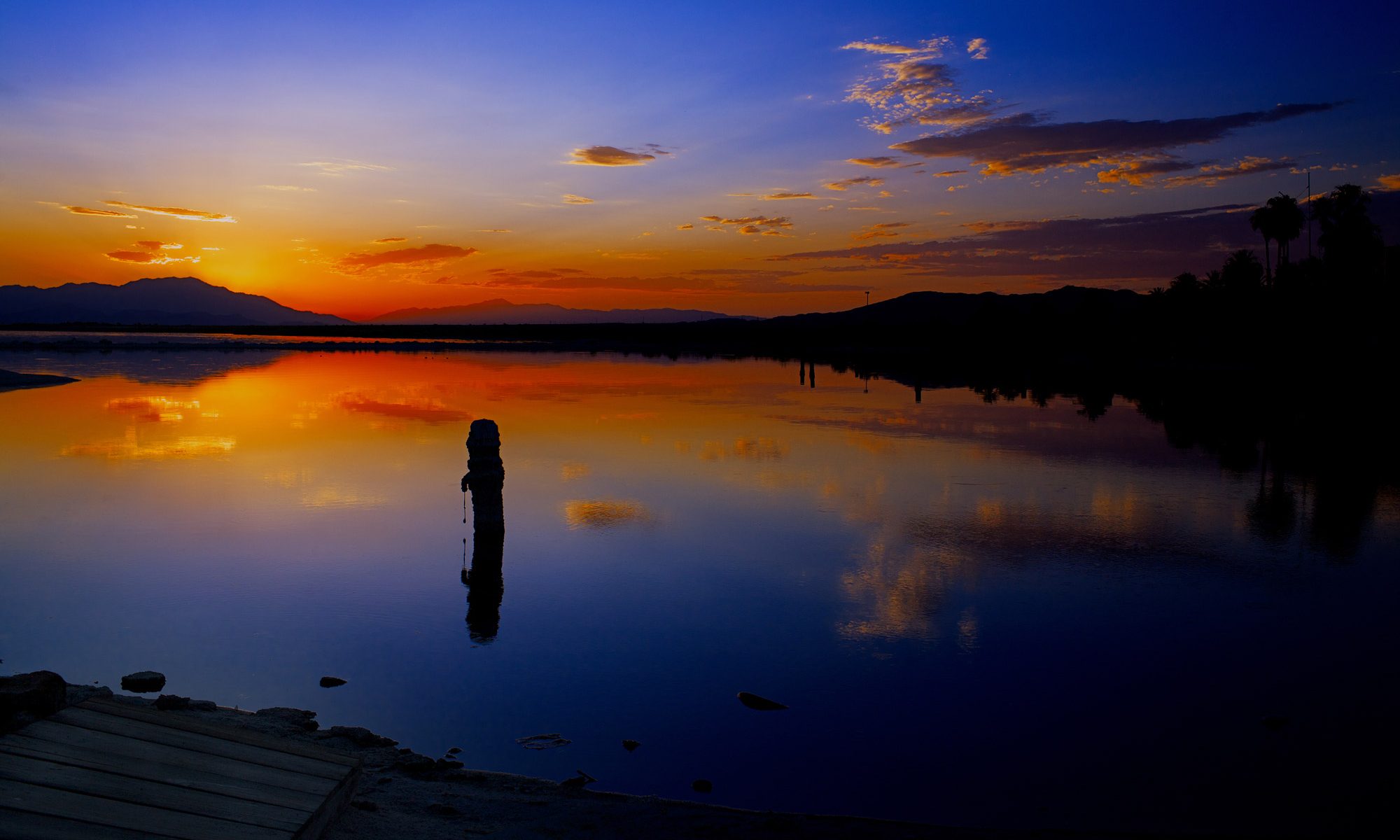
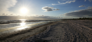
The Salton Sea spreads across a remote valley in California’s lower Colorado Desert, 40 miles (65 kilometers) from the Mexican border. For birds migrating along the Pacific coast, it’s an avian Grand Central Station. In midwinter tens of thousands of snow geese, ducks, pelicans, gulls and other species forage on and around the lake. Hundreds of other species nest there year-round or use it as a rest stop during spring and fall migration.
At the dawn of the 20th century, this massive oasis didn’t even exist. It was created in 1905 when Colorado River floodwaters breached an irrigation canal under construction in Southern California and flowed into a basin that had flooded in the past. In earlier years, the sea covered roughly 40 square miles more than its current size of 343 square miles (890 square kilometers).
Now, however, this resource is in trouble. Wasteful irrigation practices that maintained the sea have been reduced, and excess water is now being transferred to thirsty coastal cities instead. The sea’s volume has declined to roughly 4.6 million acre-feet, losing nearly 3 million acre-feet since the mid-2000s. (An acre-foot is about 326,000 gallons – the amount of water required to cover an acre of land to a depth of one foot).
PLAN – Divide the sea at the county line separating Riverside and Imperial Counties. Create a road at that point to connect HWY 111 to HWY 80. Create groundwater pumping stations surrounding the sea to access the century of water that has permeated the ground. The water that is accessed has been organically filtered naturally through decades of Colorado River water displaced since 1905.
Rob
P.S. – this will work inexpensively if anyone would listen
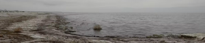
If the sun hits it just right, it looks like the ocean. Pelicans fly overhead, gently cawing and circling the horizon. The skies are a flat, dull blue. But once you walk along its spectral shoreline and feel the grit of translucent fish bones beneath your feet, you realize this cancerous body of water is anything but ordinary.
Spanning about 343 square miles and referred to as “an environmental catastrophe” by water experts, the Salton Sea is in a perpetual state of decay due to the 4 million tons of salt from agricultural runoff that flow into it each year. It’s a “terminal sea,” meaning that it has no outflow, and it has become a noxious brew that’s caused mass bird and fish die-offs over the years.
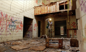
But before its fabled toxicity took hold, the Salton Sea was once a popular resort destination. It’s an unlikely icon, one that’s been featured in hundreds of films over the decades. Growing up in the confines of the suburban, sun-scorched Coachella Valley, I was always drawn to its dying waters.
In 2009, when I finally got to join my father on one of his photography trips to the area, one eerie landmark beckoned to us from a distance: an eviscerated, ghostly clubhouse near the shore. We captured its alluring decay with plastic Polaroid cameras, my eye drawn specifically to its rotting, graffitied interior. We continued through the empty building, navigating a maelstrom of trash, debris and caution tape, careful to avoid loose boards and nails. Apocryphal messages were scribbled on the walls and spray-painted inside dark closets. I distinctly remember walking past “Dead birds everywhere” and taking a photo of the dripping, blackened words “You’ll be the last one untied!!!”
Exposing the Desert Series – storymaps.arcgis.com/
Exposing The Desert Salton Sea
The Salton Sea is ecologically a part of the Colorado River watershed which comprises parts of southwestern US and northern Mexico (Vélez-Ibáñez and Heyman 2017). In an effort to colonize the southwest in the 19th century, the US Bureau of Land Reclamation and private investors sought to control the Colorado River watershed (Reisner 1986). From 1905-1907 the Salton Sea was formed when flood waters broke an irrigation canal constructed by the California Development Company. After the flood waters were controlled, the Sea was kept in order to maintain farming in the area and is officially designated as a sump, a dump for agroindustrial pollutants (De Buys 1999; Rudy 2005; Cantor and Knuth 2019).
UC Riverside study has health implications for people living around California’s largest lake.
The Salton Sea, the body of water in Southern California’s Coachella Valley and Imperial Valley, is shrinking over time as the planet warms and exposing more lakebed and new sources of dust in the process. High levels of dust already plague the region, a situation likely to worsen as the sea continues to shrink due to climate change.
Not surprisingly, the communities surrounding the Salton Sea have high rates of childhood asthma (20–22.4%) — much higher than the California average of 14.5%.
A University of California, Riverside, mouse study, led by Dr. David Lo, a distinguished professor of biomedical sciences in the School of Medicine, has found that dust collected at sites near the Salton Sea triggered lung neutrophil inflammation in mice. Neutrophils are a type of white blood cells that help fight infection.
Exposed lakebed has been linked to higher levels of dust at the Salton Sea. The dust in the Salton Sea Basin is estimated to increase by 11% between 2018 and 2030. (UCR/Stan Lim)
“We now have an important direct demonstration that chronic exposures to Salton Sea dust may have a role in the asthma in residents closest to the Salton Sea,” said Lo, who directs the Bridging Regional Ecology, Aerosolized Toxins, & Health Effects, or BREATHE, Center. Housed in the UC Riverside medical school, the center addresses critical issues in air quality and health.
“What residents near the sea are breathing is dissolved material from the sea, with microbial components that can promote inflammation,” Lo said. “As the sea continues to dry up and expose more dust-producing lakebed, it could increase concern for the residents, especially as climate change drives chronic drought in the region.”
Lo explained that dust can cause several pulmonary diseases. In the Salton Sea, contaminants such as pesticides, herbicides, heavy metals, and microbial toxins may be enriched in the dust. To examine the potentially harmful effects of this dust, the study, published in the journal Science of the Total Environment, used an environmental exposure chamber at UC Riverside.
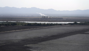
At the Salton Sea, changes in ecology, agriculture, and water rights intersect with human health, geothermal energy production, and geologic hazards. A short distance from the Mexico border, the lake is California’s largest by area, covering 343 square miles. This is changing, however, as the lake shrinks from evaporation and decreasing water input from the Colorado River. Recent changes to regional water use are also driving the rapid shrinking of the lake, leading to ecosystem collapse and increasingly frequent dust storms sourced from the dry lakebed contaminated by agricultural runoff.
This StoryMap will take you back in time to learn about the origins of the Salton Sea and discuss ongoing geologic hazards to the region around the lake. Much of the Storymap is centered around interactive maps that allow the viewer to choose how to explore the Salton Sea and surrounding region. The content of these maps comes from the USGS, Salton Sea Authority, and other organizations that study and manage the Salton Sea; a full list of reference can be found at the end. Note that many of these maps are rotated so that north is to the upper left of the screen. The data used is from publicly available sources noted at the base of each map. Although the sections of this Storymap are meant to be read sequentially; if viewers are interested, the tabs at the top of the screen link to individual sections.
Local, state officials welcome federal funds for environmental projects
By Ian James
A DRY PORTION of the Salton Sea, California’s largest lake. Photographs by Marcio Jose Sanchez Associated Press
The Biden administration has announced a plan to provide $250 million to accelerate environmental projects around the shrinking Salton Sea, a major commitment intended to help revitalize the lake’s ecosystems and control hazardous dust in a deal that clears the way for California to take less water from the drought-ravaged Colorado River.
Leaders of the Imperial Irrigation District, which uses the single largest share of the Colorado River to supply farms in the Imperial Valley, had called for federal money to support the state’s Salton Sea program as a key condition for participating in water cutbacks. Some of the district’s leaders praised the funding commitment from the Interior Department and the Bureau of Reclamation, calling it a historic step toward addressing the windblown dust and deteriorating habitats that have plagued California’s largest lake.
“This checks the box big time,” said J.B. Hamby, an Imperial Irrigation District board member. “It’s a really big deal, and nothing like this has really ever happened before.”
This year, federal officials demanded large-scale water cutbacks throughout the Southwest to try to prevent the Colorado River’s reservoirs from dropping to dangerously low levels. Four major California water districts have proposed reducing water use by up to 400,000 acre-feet per year for the next four years, about 9% of the state’s total water allotment.